

")
")


The development of a methodology for describing the quality of geodetic measurements, 1930 – 1980
Martien Molenaar, Vertaling: Roel Nicolaï
Nederlandse Commissie voor Geodesie 58, Delft, 2022. 70 pagina's.
ISBN: 978 90 6132 346 4
DOI: 10.54419/pfttmr
During the twentieth century and particularly in its second half, a number of developments took place at the Faculty of Geodesy of Delft University of Technology that drew much attention, nationally, but definitely also internationally. These developments exerted an increasing influence on professional practice in geodesy and land surveying....
Nederlandse Commissie voor Geodesie 57, Delft, 2014. 15 pagina's.
Intreerede van prof.dr. J.E. Stoter uitgesproken op 29 oktober 2014 ter gelegenheid van de aanvaarding van het ambt van hoogleraar "Spatial Data Infrasructure" aan de Faculteit Bouwkunde...
Nederlandse Commissie voor Geodesie 56, Delft, 2012. 60 pagina's.
ISBN: 978 90 6132 333 4.
De werkgroep 3D Use cases had als doel om behoefte aan 3D geo-informatie en 3D technieken te specificeren door het definiëren en uitvoeren van 'use cases'. De use cases vormden een belangrijke motor van de 3D pilot. Het uitvoeren van de use cases is in nauw overleg gedaan met informatie en data-aanbieders (werkgroep Aanbod van 3D geo-informatie) en het 3D testbed (werkgroep 3D Testbed). De ervaringen die tijdens het uitvoeren van de use cases zijn opgedaan, zijn vervolgens weer gebruikt om...
Publicatie n.a.v. de studiedag 'Open geodata: van ideaal naar realiteit' op 9 november 2011 in Amersfoort georganiseerd door Geonovum in samenwerking met ICTU
Marèse Peters (interviews), Bastiaan van Loenen en Yvonne Verdonk (redactie)
Nederlandse Commissie voor Geodesie 55, Delft, 2012. 39 pagina's.
ISBN: 978 90 6132 334 1.
Open data staat hoog op de beleidsagenda. In maart 2011 omarmde minister Verhagen van het ministerie van Economische Zaken, Landbouw en Innovatie (EL&I) open data in zijn Digitale Agenda NL. In mei 2011 kondigde minister Donner van het ministerie van...

Edward Verbree, Theo Tijssen, Hugo Ledoux, Sisi Zlatanova
Nederlandse Commissie voor Geodesie 54, Delft, 2012. 35 pagina's.
ISBN: 978 90 6132 332 7.
In de 3D Pilot – een initiatief van het Kadaster, Geonovum, de Nederlandse Commissie voor Geodesie (NCG) en het ministerie van Infrastructuur en Milieu – hebben meer dan 60 organisaties het afgelopen jaar samengewerkt om toepassing van 3D geo-informatie een impuls te geven. Eén van de activiteiten van de 3D Pilot, uitgevoerd door de Sectie GIS-technologie van het Onderzoeksinstituut OTB van de TU Delft, is het ontwikkelen van een testbed, die de samenwerking tussen al...

Leon van Berlo, Linda van den Brink, Marcel Reuvers, Jantien Stoter, Sisi Zlatanova
Nederlandse Commissie voor Geodesie 53, Delft, 2011. 62 pagina's.
ISBN: 978 90 6132 331 0.
De werkgroep 3D Standaard NL heeft zich, zoals de naam van de werkgroep al aanduidt, beziggehouden met het formuleren van aanbevelingen over...
Joris Goos, Rick Klooster, Jantien Stoter, Edward Verbree, Gerbrand Vestjens, George Vosselman
Nederlandse Commissie voor Geodesie 52, Delft, 2011. 86 pagina's.
ISBN: 978 90 6132 330 3.
De werkgroep Aanbod van 3D geo-informatie heeft een ruime hoeveelheid datasets op de testlocatie in Rotterdam (2D en 3D, raster en vector, kleinschalig en grootschalig, uit inwinning en uit bestaande registraties) verzameld. Via een door de TU Delft ter beschikking gestelde dataserver zijn deze datasets (maar ook enkele tools, presentaties en toelichtingen) door...
Jantien Stoter, Joris Goos, Rick Klooster, Marcel Reuvers, Edward Verbree, Gerbrand Vestjens, George Vosselman
Nederlandse Commissie voor Geodesie 51, Delft, 2011. 30 pagina's.
ISBN: 978 90 6132 329 7.
De afgelopen tien jaar zijn technologieën voor het genereren en beheren van 3D geo-informatie uitgegroeid tot volwassen producten. Tegelijkertijd zijn de kosten voor 3D geo-informatie en 3D toepassingen aanzienlijk verminderd. Toch aarzelen veel (overheids) organisaties om...
Studiemiddag over temporele aspecten van geografische gegevens, georganiseerd door de Subcommissie Geo-Informatie Infrastructuur van de NCG en Geo-Informatie Nederland (GIN) op donderdag 17 september 2009 te Utrecht
Nico Bakker, Leen Breure, Wilko Quak (redactie)
Nederlandse Commissie voor Geodesie 50, Delft, 2010. 80 pagina's.
ISBN: 978 90 6132 325 9.
Het begrip tijd is in geografische bestanden vaak moeilijk weer te geven. Reeksen van oude en nieuwere kaarten laten ontwikkelingen zien, maar het juiste moment van wijziging is daarbij vaak niet meer te achterhalen. In het huidige digitale tijdperk is het daarentegen mogelijk om...
P.J.M. van Oosterom, M.G. Vosselman, Th.A.G.P. van Dijk, M. Uitentuis (Editors)
Nederlandse Commissie voor Geodesie 49, Delft, 2010. 104 pagina's.
ISBN: 978 90 6132 322 8.
This publication contains a selection of papers that result of the seminar ‘Management of massive point cloud data: wet and dry’ on Thursday 26 November 2009 at Oracle, De Meern, the Netherlands. This seminar was jointly organized by the subcommissions 'Marine Geodesy' and 'Core Spatial Data' of...
B. van Loenen, J.W.J. Besemer, J.A. Zevenbergen (Editors)
Nederlandse Commissie voor Geodesie 48, Delft, 2009. 288 pagina's.
ISBN: 978 90 6132 310 5.
This book is the result of a collaborative initiative of the Global Spatial Data Infrastructure Association (GSDI), the European Commission's Joint Research Centre, the European umbrella organisation for geographic information (EUROGI), the Dutch innovation program Space for...
NCG seminar on the occasion of the 25th year jubilee of Mathias J.P.M. Lemmens at TU Delft
Peter J.M. van Oosterom (Editor)
Nederlandse Commissie voor Geodesie 47, Delft, 2009. 96 pagina's.
ISBN: 978 90 6132 317 4.
This publication is a very special one for several reasons. First of all it is on the happy occasion of the 25th jubilee of Tjeu Lemmens at the TU Delft, which makes it a very pleasant setting. Second, this publication is the first publication of...
Proceedings of the Workshop on Assessment and Socio-economic Aspects of Spatial Data Infrastructures
Bastiaan van Loenen (Editor)
Nederlandse Commissie voor Geodesie 46, Delft, 2008. 99 pagina's.
ISBN: 978 90 6132 308 2.
Socio-economic aspects of geographic information (infrastructures) (GII) are increasingly considered in GII development and especially in GII research. Where once the technological dimension of GII was the dimension assessed to be most relevant, it is now commonly understood that also the non-technical aspects should be addressed and understood in...
Michel Grothe and Jan Kooijmans (Editors)
Nederlandse Commissie voor Geodesie 45, Delft, 2008. 87 pagina's.
ISBN: 978 90 6132 305 1.
In the geo-information community in the Netherlands the concept of Spatial Data Infrastructures has gained increasing attention. In the last two years this has led to several implementations especially in geoportals, operational web mapping services for...
Peter J.M. van Oosterom and Marc. J. van Kreveld (Editors)
Nederlandse Commissie voor Geodesie 44, Delft, 2006. 62 pagina's.
ISBN-13: 978 90 6132 299 3. ISBN-10: 90 6132 299 5.
Geographic Information Science (GIS) is a multi-disciplinary research area. Contributions from the spatial sciences come from geodesy, geography, and cartography, whereas contributions from computer science come from...
Definitie en vastlegging van ETRS89, RD en NAP en hun onderlinge relaties
Arnoud de Bruijne, Joop van Buren, Anton Kösters, Hans van der Marel
Nederlandse Commissie voor Geodesie 43, Delft, 2005. 132 pagina's.
ISBN-13: 978 90 6132 291 7. ISBN-10: 90 6132 291 X.
Voor een goede bepaling van ligging en hoogte wordt gebruik gemaakt van eenduidige en homogene geodetische referentiestelsels. In Nederland zijn dit de stelsels van de Rijksdriehoeksmeting (RD) voor de ligging en het Normaal Amsterdams Peil (NAP) voor de hoogte. Traditioneel wordt het RD beheerd door...
NCG/GIN Farewell Seminar Henri J.G.L. Aalders, Delft, 17 November 2004
Peter J.M. van Oosterom (Editor)
Nederlandse Commissie voor Geodesie 42, Delft, 2005. 98 pages.
ISBN-13: 978 90 6132 289 4. ISBN-10: 90 6132 289 8.
This publication is the result of the seminar ‘Standards in action’ on 17 November 2004 jointly organized by ‘Geo-Informatie Nederland’ (GIN, section Geo-ICT) and Netherlands Geodetic Commission, sub commission Geo-Information Models (NCG-GIM). The seminar is organized in...
H.C. Pouls
Nederlandse Commissie voor Geodesie 41, Delft, 2004. 102 pagina's.
ISBN-13: 978 90 6132 287 0. ISBN-10: 90 6132 287 1.
In 1612 verscheen van de hand van de landmeter Jan Pietersz. Dou een boekje met de titel: Tractaet vant maken ende Gebruycken eens nieu gheordonneerden Mathematischen Instruments. In dit boekje werd, zoals de titel zegt, een nieuw landmeetkundig instrument beschreven. Dou was daartoe gekomen omdat hij niet tevreden was met...
Inleidingen van de studiedag over metagegevens voor geografische informatie, Subcommissie Geo-Informatie Modellen, Utrecht, 18 mei 2004
L. Heres (redactie)
Nederlandse Commissie voor Geodesie 40, Delft, 2004. 62 pagina's.
ISBN-13: 978 90 6132 285 6. ISBN-10: 90 6132 285 5.
Meta-informatie, iets nieuws onder de zon?
De term meta-informatie is relatief nieuw. Bernard Plagman, auteur van Data Dictionary and Directory Systems heeft de term als eerste gebruikt in een artikel uit 1971, zegt men. En hoewel je altijd wat voorzichtig moet zijn met dit soort claims, is het duidelijk dat de term uit...
Hoe precies moet het? Hoe moet het precies?
F.B.J. Barends, F. Kenselaar, F.H. Schröder (redactie)
Nederlandse Commissie voor Geodesie 39, Delft, 2002. 100 pagina's.
ISBN-13: 978 90 6132 279 5. ISBN-10: 90 6132 279 0.
Op de themadag Monitoring van bodemdaling in Nederland, op 27 november 2001, is door de Subcommissie Bodembeweging en Zeespiegelvariatie van de Nederlandse Commissie voor Geodesie (NCG) een visie gepresenteerd op de invulling van haar missie, namelijk het zorgvuldig vaststellen en volgen van...
Voordrachten gehouden ter gelegenheid van de opening van het Astrometrisch-Geodetisch Observatorium te Westerbork, 24 september 1999
L. Aardoom (redactie)
Nederlandse Commissie voor Geodesie 38, Delft, 2000, 49 pagina's,
ISBN-13: 978 90 6132 272 6. ISBN-10: 90 6132 272 3.
De publicatie bevat de voordrachten die gehouden zijn ter gelegenheid van de opening van het Astrometrisch-Geodetisch Observatorium te Westerbork op 24 september 1999. Als aanhangsel is opgenomen de bestuurlijke samenvatting van het rapport 'De wetenschappelijke rol van...
Gemma Frisius
Met een inleiding en nabeschouwing door H.C. Pouls
Nederlandse Commissie voor Geodesie 37, Delft 1999, 48 pagina's,
ISBN-13: 978 90 6132 268 9. ISBN-10: 90 6132 268 5.
In 1533 verscheen een publicatie die van grote betekenis zou blijken te zijn voor de ontwikkeling van de landmeetkunde. Deze publicatie betrof een door Gemma Frisius bewerkte Latijnse uitgave van Petrus Apianus' "Cosmographicus Liber", die door Frisius voorzien was van...
L. Heres (redactie)
Nederlandse Commissie voor Geodesie 36, Delft 1998, 72 pagina's.
ISBN-13: 978 90 6132 263 4. ISBN-10: 90 6132 263 4.
Het gaat beslist te ver om te zeggen dat 'kwaliteit' een geheel nieuw onderwerp is in de geo-informatica. Al sinds mensenheugenis zijn geodeten immers gewoon om de kwaliteit van hun metingen te bewaken en te evalueren. Al die jaren hebben ze ook continu gewerkt aan...
G.B.M. Brand, J. van Buren, H. van der Marel en R.E. Molendijk
Nederlandse Commissie voor Geodesie 35, Delft 1997, 39 pagina's.
ISBN-13: 978 90 6132 262 7. ISBN-10: 90 6132 262 6.
De Europese vereffening heeft door het gebruik van het Global Positioning System (GPS) een kwaliteit bereikt die beter is dan die van het nationale stelsel van de Rijksdrie-hoeksmeting (RD). Het stelsel van de Europese vereffening wordt aangeduid als European Terrestrial Reference System 1989 (ETRS89) en is tot stand gekomen door...
Erik de Min
Nederlandse Commissie voor Geodesie 34, Delft 1996, 224 pagina's.
ISBN-13: 978 90 6132 257 3. ISBN-10: 90 6132 257 X.
De combinatie van GPS-metingen met geoïdehoogteverschillen levert orthometrische hoogteverschillen op die kunnen worden gebruikt als controle op, of vervanging van waterpasmetingen. Omdat voor deze orthometrische hoogten (NAP-hoogten) voor...
René van der Schans (redactie)
Nederlandse Commissie voor Geodesie 33, Delft 1995, 88 pagina's.
ISBN-13: 978 90 6132 250 4. ISBN-10: 90 6132 250 2.
Op 6 oktober 1994 vond bij de Topografische Dienst in Emmen een studiedag plaats over de relatie tussen Digitale Landschaps-Modellen (DLM) en Digitale Kartografische Modellen (DKM). Deze studiedag was georganiseerd door de Subcommissie GIS van...
Erik de Min
Nederlandse Commissie voor Geodesie 32, Delft 1995, 160 pagina's.
ISBN-13: 978 90 6132 251 1. ISBN-10: 90 6132 251 0.
In dit verslag zal worden ingegaan op de bovengenoemde eerste orde zwaartekrachtnetten.
Voor ieder net wordt uitgebreid beschreven hoe het net er uit ziet, hoeveel waarnemingen zijn gedaan, wat de resultaten van de vereffening zijn, welke precisie en betrouwbaarheid zijn gehaald en tevens zal de stabiliteit en toegankelijkheid van...
Nederlandse Commissie voor Geodesie
Nederlandse Commissie voor Geodesie 31, Delft 1995, 98 pagina's.
ISBN-13: 978 90 6132 252 8. ISBN-10: 90 6132 252 9.
In haar vergadering van 8 december 1992 besloot de Nederlandse Commissie voor Geodesie (NCG) de Subcommissie "Nationaal Geodetisch Plan" in te stellen. Bij haar installatie op 24 februari 1993 kreeg de subcommissie tot taak: "Het geven van een raamwerk voor...
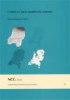
Govert Strang van Hees
Nederlandse Commissie voor Geodesie 30, Delft 2006. 84 pagina's.
4e herziene druk. ISBN-13: 978 90 6132 294 8. ISBN-10: 90 6132 294 4.
Aan het eind van de 19e eeuw ontwikkelde elk land zijn eigen nationale geodetische coördinaatsysteem. Om de in dat land best passende ellipsoïde af te beelden op een plat vlak, werd een eigen projectiemethode aangenomen al of niet via een projectie op...
L. Aardoom
Nederlandse Commissie voor Geodesie 29, Delft 1992, 62 pagina's.
ISBN-13: 978 90 6132 242 9. ISBN-10: 90 6132 242 1.
De in opdracht van de toenmalige Raad van Advies voor het Wetenschapsbeleid (RAWB) in 1990 verrichte verkenning op het gebied van het civieltechnisch en geodetisch onderzoek in Nederland en het naar aanleiding van de uitkomsten daarvan uitgebrachte advies (zie verwijzing naar Geraadpleegde literatuur) deden de Nederlandse Commissie voor...
M.H. Koert
Nederlandse Commissie voor Geodesie 28, Delft 1988, 142 pagina's.
ISBN-13: 978 90 6132 236 8. ISBN-10: 90 6132 236 7.
De absolute eigendom van onroerend goed wordt, behalve door rechten waaraan een privaatrechtelijke rechtsverhouding ten grondslag ligt, in toenemende mate beperkt door rechten van publiekrechtelijke aard. Deze van overheidswege opgelegde eigendoms- en gebruiksbeperkingen met betrekking tot...
H.L. Rogge
Nederlandse Commissie voor Geodesie 27, Delft, 1985. 229 pagina's.
ISBN-13: 978 90 6132 234 4. ISBN-10: 90 6132 234 0.
Het tweede deel van het Register bevat de titels (van artikelen in een vreemde taal, voornamelijk Engels) en trefwoorden (bi j artikelen in het Nederlands), welke betrekking hebben op alle tijdschriften en publicatiereeksen die zijn opgenomen in...
H.L. Rogge
Nederlandse Commissie voor Geodesie 26, Delft, 1984. 218 pagina's.
ISBN-13: 978 90 6132 231 3. ISBN-10: 90 6132 231 6.
In 1975 publiceerde de Rijkscommissie voor Geodesie een 'Register op landmeetkundige literatuur in Nederland, 1961-1970'. Dat Register was door mij in de voorgaande jaren samengesteld. In de Inleiding tot het Register schreef ik het te betreuren dat kartografische en hydrografische publikaties in...
J.C. Anneveld
Nederlandse Commissie voor Geodesie 25, Delft, 1984. 239 pagina's.
ISBN-13: 978 90 6132 229 0. ISBN-10: 90 6132 229 4.
In hoofdstuk 1, Inleiding, wordt uiteengezet dat deze ingenieursscriptie het verslag is van een onderzoek naar eisen betreffende en verschaffing van zekerheid omtrent eigendomsgrenzen van onroerend goed. Verklaard wordt waarom voor de term zekerheid is gekozen en niet voor...
J.B.Ch. Wekker
Nederlandse Commissie voor Geodesie 24, Delft, 1983. 216 pagina's.
ISBN-13: 978 90 6132 228 3. ISBN-10: 90 6132 228 6.
a. Geschiedenis
De karteringsgeschiedenis van Suriname is onlosmakelijk verbonden met de koloniale politiek en de ontwikkeling van de Nederlandse kartografie. Vanuit die optiek is het zinvol de karteringsgeschiedenis te doen vooraf gaan door een beknopt overzicht van...
N. van der Schraaf (Editor)
Nederlandse Commissie voor Geodesie 23, Delft, 1979. 228 pagina's.
ISBN-13: 978 90 6132 029 6. ISBN-10: 90 6132 029 1.
Last year the Netherlands Geodetic Commission decided to mark its hundredth anniversary, 20th February, 1979, with some kind of celebration. In the hundred years of its existence the Commission has not sought much publicity for its work. It is true that the publications and annual reports of..,
A. Waalewijn
Nederlandse Commissie voor Geodesie 22, Delft, 1979. 228 pagina's.
ISBN-13: 978 90 6132 030 2. ISBN-10: 90 6132 030 5.
Met de publicatie van dit verslag wordt een lang geleden verstrekte opdracht vervuld. Men kan zich afvragen of het nog nut heeft dit verslag zo veel jaren na de voltooiing van de tweede nauwkeurigheidswaterpassing uit te brengen. Ik heb gemeend deze vraag in...
P. Richardus (Editor)
Nederlandse Commissie voor Geodesie 21, Delft, 1977. 347 pagina's.
ISBN-13: 978 90 6132 028 9. ISBN-10: 90 6132 028 3.
N.D. Haasbroek
Nederlandse Commissie voor Geodesie 20, Delft, 1977. 280 pagina's.
ISBN-13: I978 90 6132 027 2. ISBN-10: 90 6132 027 5.
Sedert ongeveer tien jaar bevindt zich in het archief van de Rijkscommissie voor Geodesie te Delft een collectie van 208 brieven en rekeningen verzonden door of gericht aan de beroemde astronoom en directeur van de Leidse Sterrenwacht prof.dr. F. Kaiser (1808-1872). Na diens dood is de collectie bijna een eeuw aan...
H.L. Rogge
Nederlandse Commissie voor Geodesie 19, Delft, 1975. 322 pagina's.
ISBN-13: 978 90 6132 026 5. ISBN-10: 90 6132 026 7.
Ruim tien jaar geleden stelde ik een "Register op het Tijdschrift voor Kadaster en Landmeetkunde, en aanverwante periodieken", samen over de jaren 1935 - 1960. De "ingang" op dat Register waren: schrijversnamen en trefwoorden. Die stonden, door elkaar, in één doorlopende, alfabetisch
gerangschikte lijst, volgens het z.g. "dictionary-catalogue system" ("kruis-catalogus-stelsel").
Volgens hetzelfde beginsel stelde ik thans een vervolg op...
N.D. Haasbroek
Nederlandse Commissie voor Geodesie 18, Delft, 1974. 144 pagina's.
ISBN-13: 978 90 6132 025 8. ISBN-10: 90 6132 025 9.
The motive for Stamkart's triangulation carried out in the Netherlands, between 1866 and 1881, is already mentioned in the first section of Haasbroek's publication on the accuracy of Krayenhoffls triangulation and in the very detailed paper by...
T.J. Poelstra
Nederlandse Commissie voor Geodesie 17, Delft, 1974. 26 pagina's.
ISBN-13: 978 90 6132 024 1. ISBN-10: 90 6132 024 0.
The Working Group for Satellite Geodesy is part of the Sub-Department of Geodesy of the Delft University of Technology (THD) and is represented in the Netherlands Committee for Geophysics and Space Research (GROC) of the Royal Netherlands Academy of Sciences.
It has been assigned the tasks of...
N.D. Haasbroek
Nederlandse Commissie voor Geodesie 16, Delft, 1972. 222 pagina's.
ISBN-13: 978 90 6132 023 4. ISBN-10: 90 6132 023 2.
Krayenhoff's triangulation in a part of Belgium, The Netherlands ( with the exception of the province of Limburg ), and a part of northwestern Germany, carried out between 1802 and 1811 and published in his Precis Historique was praised to the skies shortly after...
P.I. van der Weele
Nederlandse Commissie voor Geodesie 15, Delft, 1971. 44 pagina's.
ISBN-13: 978 90 6132 022 7. ISBN-10: 90 6132 022 4.
Tijdens de publicatie van de resultaten van de tweede primaire waterpassing van Nederland door de Meetkundige Dienst van de Rijkswaterstaat werd van verschillende zijden de gedachte geopperd dat het de moeite waard zou zijn een onderzoek in te stellen naar...
N.D. Haasbroek
Nederlandse Commissie voor Geodesie 14, Delft, 1968. 119 pagina's.
ISBN-13: 978 90 6132 021 0. ISBN-10: 90 6132 021 6.
In the past few years several papers in the Dutch language have been published on the triangulation of the Dutchman Snellius (Willebrord Snel van Royen, 1580 - 1626). It seems to be justified to bring these papers in a somewhat different form and in...
Report on the results of the measurements performed by T.J. Kukkamäki and T. Honkasalo of the Finnish Geodetic Institute
G.J. Bruins (Editor)
In 1913 the primary triangulation network of the Netherlands was augmented with a base line. This base line was measured near Stroe and the results of the measurements were published by Prof. Ir. Hk.J. Heuvelink in 1931.*)
The object of this base line measurement was to check the unit of...
D. de Groot
Nederlandse Commissie voor Geodesie 12, Delft, 1961. 38 pagina's.
ISBN-13: 978 90 6132 019 7. ISBN-10: 90 6132 019 4.
De hierna volgende tafels van de goniometrische functies in tien decimalen zijn reeds geruime tijd geleden berekend door de heer D. de Groot, Hoofd van het Bureau voor Buitengewoon Landmeetkundig Werk te Utrecht.
Hoewel de tafels eerst nu in druk verschijnen, hebben in...
Complete results with isostatic reduction
G.J. Bruins (Editor)
Nederlandse Commissie voor Geodesie 11, Delft, 1960. 111 pagina's.
ISBN-13: 978 90 6132 018 0. ISBN-10: 90 6132 018 6.
After the second World War, the Netherlands Geodetic Commission again took up the organization of gravity measurements at sea. The method of measurement and the apparatus which were developed and used during the years 1923 - 1938 by Prof.Dr. F.A. Vening Meinesz, resulted during that period in...
N.D. Haasbroek
Nederlandse Commissie voor Geodesie 10, Delft, 1955. 176 pagina's.
ISBN-13: 978 90 6132 017 3. ISBN-10: 90 6132 017 8.
As far as I know little has been published in literature concerning land surveying about the accuracy of plotting and scaling-off with divider and plotting scale or with tracing point and engineer scale. Only a rather circumstantial paper by...
Complete results with isostatic reduction, interpretation on the results
F.A. Vening-Meinesz
Nederlandse Commissie voor Geodesie 9, Delft, 1948. 233 pagina's.
ISBN-13: 978 90 6132 015 9. ISBN-10: 90 6132 015 1.
This publication contains a list of the complete results of the gravity expeditions at sea of the Netherlands Geodetic Commission up to the year 1938, i.e. of 844 stations, isostatically reduced according to the Hayford-Bowie reduction and to the Airy reduction for local compensation and for five degrees of regionality of the compensation, for crustal thicknesses T of 20 km and of 30 km.
It further contains an attempt at an interpretation of...
J.E. de Vos van Steenwijk
Nederlandse Commissie voor Geodesie 8, Delft, 1946. 23 pagina's.
ISBN-13: 978 90 6132 014 2. ISBN-10: 90 6132 014 3.
The Netherlands Geodetic Commission publishes here a study made during the war by Dr. J. E. baron de Vos van Steenwijk about the shape of the geoid and the plumbline deflections in East Indonesia as derived from the gravity data in this area. For the first time the formulas expressing these relations have been applied here in...
F.A. Vening-Meinesz
Nederlandse Commissie voor Geodesie 7, Delft, 1941. 77 pagina's.
ISBN-13: 978 90 6132 013 5. ISBN-10: 90 6132 013 5.
The purpose of this publication is to give tables for the gravity effect of the isostatic compensation according to the Airy hypothesis of a floating crust and assuming a regional distribution of the compensating masses. For making the tables more complete and in order to allow a better comparizon, a first column has been added to the tables corresponding to local compensation. The figures of these last mentioned columns are identical to those of...
F.A. Vening-Meinesz
Nederlandse Commissie voor Geodesie 6, Delft, 1941. 89 pagina's.
ISBN-13: 978 90 6132 009 8. ISBN-10: 90 6132 009 7.
Chapter I contains the theoretical investigations about the effect of the accelerations of the pendulum apparatus on the gravity results. § I treats of the effect of the horizontal component perpendicular to the swinging plane of the main pendulums, § 2 of that of the second horizontal component, § 3 of that of the vertical component and § 4 of the rotational effects. In all cases the effect has been determined up to the terms proportional to...
F.A. Vening-Meinesz
Nederlandse Commissie voor Geodesie 5, Delft, 1941. 97 pagina's.
ISBN-13: 978 90 6132 007 4. ISBN-10: 90 6132 007 0.
This publication contains a report of the gravity at sea expeditions of the Netherlands Geodetic Commission in the years 1934 to 1939. It gives an account of the expeditions, the observations, the computation of the results and of their mean errors; the last table lists the gravity reduced to...
F.A. Vening-Meinesz, J.H.F. Umbgrove and Ph.H. Kuenen
Nederlandse Commissie voor Geodesie 4, Delft, 1964. 208 pagina's.
Second edition. ISBN-13: 978 90 6132 004 3. ISBN-10: 90 6132 004 6.
The interpretation of gravity anomalies is a subject about which the opinions are yet divided. This results from its many-sided character. The problem has no unique mathematical solution and so only the combination of the gravity data with data from...
F.A. Vening-Meinesz
Nederlandse Commissie voor Geodesie 3, Delft, 1932. 109 pagina's.
ISBN-13: 978 90 6132 003 6. ISBN-10: 90 6132 003 8.
This volume contains the report of the maritime gravity expeditions of the Netherlands Geodetic Commission during the years 1923-1930. The results are reduced to sea-level without further reduction; they are put together in the list on pages 101 et seq.
A second volume will contain the isostatic reductions of the results and the discussion of their interpretation.
During the Gravity Survey of Holland in...
F.A. Vening-Meinesz
Nederlandse Commissie voor Geodesie 2, Delft, 1929. 95 pagina's.
ISBN-13: 978 90 6132 002 9. ISBN-10: 90 6132 002 X.
To facilitate the use of this publication, a short summary will be given of the contents.
The first chapter contains the theory of the method for determining gravity at sea by means of pendulum observations. The results of these theoretical considerations, i.e. the formulae for the corrections and reductions which have to be applied to the observed pendulum-period, are put together in § 8. § 9 indicates the principal arrangement of...
F.A. Vening-Meinesz
Nederlandse Commissie voor Geodesie 1, Delft, 1923. 146 pagina's.
ISBN-13: 978 90 6132 001 2. ISBN-10: 90 6132 001 1.
Le résumé succinct qui fait l'objet des lignes suivantes, permettra le lecteur de s'orienter préalablement sur les sujets traités dans les divers chapitres de cette publication.
Le premier chapitre contient une exposition théorique des méthodes d'observation et des formules employées. La mobilité du sol dans une partie des Pays-Bas sur laquelle le § 1 fournit quelques renseignements, a donné lieu à chercher des méthodes spéciales par...