Seminar on sensor web enablement >>
The Subcommission Geo-Information Models (GIM) of the NCG organizes on Thursday 1 February 2007 a seminar on the development and the application of 'Sensor web enablement'. The seminar will be held in the Auditorium of TNO Bouw en Ondergrond, Princetonlaan 6 in Utrecht. The seminar language is English.
(27-11-2006)
Publications on Geodesy available as pdf-file >>
All publications in the series Publications on Geodesy and the recent publications in the Green series are available as pdf-file (free of charge). In the course of 2007 all the publications in the Green series will available as pdf. (28-11-2006)
Research projects Geodetic infrastructure >>
Dr.ir. P. Ditmar (TU Delft) has made an overview of the research projects on the working field of the Subcommission Geodetic Infrastructure and Reference Systems. The overview counts ca. 25 projects on Galileo, GNSS, positioning, meteorology, gravity field and geoid, o.a.
(5-10-2006)
Semantic interoperability of distributed geo-services >>
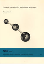
In the series 'Publications on Geodesy' has been published: 'Semantic interoperability of distributed geo-services' by Rob Lemmens.
Delft, 2006. 308 pages.
ISBN-13: 978 90 6132 298 6. ISBN-10: 90 6132 298 7. € 16.00
(19-9-06)
Automatic reconstruction of industrial installations using point clouds and images >>
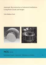
In the series 'Publications on Geodesy' has been published: Automatic reconstruction of industrial installations using point clouds and images by Tahir Rabbani Shah.
Delft, 2006. 194 pages.
ISBN-13: 978 90 6132 297 9. ISBN-10: 90 6132 297 9. € 11.00
Precise relative positioning of formation flying spacecraft using GPS >>
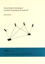
In the series 'Publications on Geodesy' has been published: Precise relative positioning of formation flying spacecraft using GPS by Remco Kroes.
Delft, 2006. 184 pages.
ISBN-13: 978 90 6132 296 2. ISBN-10: 90 6132 296 0. € 10.50
Improved capabilities to predict dredging operations by high precision riverbed mapping in heavy shipping traffic regions >>
The Board of the NCG has awarded the request of the Subcommission Marine Geodesy to support financially the Ph.D. research project 'Improved capabilities to predict dredging operations by high precision riverbed mapping in heavy shipping traffic regions'. The researcher of the project is Ir. Jeroen van den Ameele (TU Delft).
(7-2-05)
Spatial data quality: from description to application >>
In the series 'Publications on Geodesy' has been published: Spatial data quality: from description to application by Pepijn van Oort.
Delft, 2005. 140 pages. ISBN 90 6132 295 2. € 7.50.
(16-01-2005)


