

")
")


The Netherlands Geodetic Commission (NCG, part of the Royal Netherlands Academy of Arts and Sciences; KNAW) and Geo Information Netherlands (GIN) has organized a one day seminar 'Geo-information and Computational Geometry' on 14 November 2005. The seminar was held in the Blauwe Zaal in the Wentgebouw, known as the 'De Ponskaart', at Utrecht University, The Netherlands.
The main purpose was to show several different aspects related to spatial data structures and algorithms, which are normally not directly visible to the GIS end-users. The seminar was intended for a more technology-oriented audience, though the presenters are asked to find right balance not explaining all (basic) details and presenting the technology in a comprehensible manner.
Program
10.30 Arrival, coffee
11.00 Welcome, Peter van Oosterom (TUD)
11.05 Computational geometry: Its objectives and relation to GIS, Marc van Kreveld (UU)
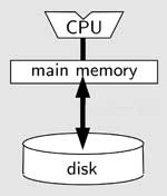
11.50 I/O- and cache-efficient agorithms for spatial data, Mark de Berg (TUE)
12.35 Lunch
13.30 Quad-edges and Euler operators for automatic building extrusion using LiDAR data, Chris Gold (Glamorgan, UK)
14.15 Algorithms for cartograms and other geo-information visualization techniques, Bettina Speckmann (TUE)
15.00 Break, thea, coffee
15.30 Constrained tetrahedral models and update algorithms for topographic data, Friso Penninga (TUD)
16.15 PCRaster developments, 3D map algebra and error propagation, Derek Karssenberg (UU)
17.00 Drinks
Abstracts
Hand-outs en presentations (pdf's)
- Computational geometry: Its objectives and relation to GIS, Marc van Kreveld (UU)
- I/O- and cache-efficient agorithms for spatial data, Mark de Berg (TUE)
- Constrained tetrahedral models and update algorithms for 3D topography, Friso Penninga (TUD)
- Dynamic modelling in GIS: modelling in three spatial dimensions and error propagation modelling, Derek Karssenberg (UU)