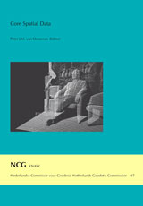
NCG seminar on the occasion of the 25th year jubilee of Mathias J.P.M. Lemmens at TU Delft
Peter J.M. van Oosterom (Editor)
Nederlandse Commissie voor Geodesie 47, Delft, 2009. 96 pagina's.
ISBN: 978 90 6132 317 4.
From the Introduction
This publication is a very special one for several reasons. First of all it is on the happy occasion of the 25th jubilee of Tjeu Lemmens at the TU Delft, which makes it a very pleasant setting. Second, this publication is the first publication of the new KNAW/NCG Subcommission 'Ruimtelijke Basisgegevens' (or in English 'Core Spatial Data'). Finally, the NCG research oriented approach to the topic of the Core Spatial Data has its counterpart in practice with the recent legislation on key registers of which several are containing spatial data. The topic of Core Spatial Data is very close to the interests of Tjeu Lemmens and it is therefore great that the authors in this publication were willing to contribute. Many of the authors are in one way or another (former) colleagues of Tjeu.
Besides organizing seminars to exchange knowledge and discuss open problems, an important activity of an NCG subcommission is to specify a common research agenda for the field. The previous research agenda of the NCG Subcommission GIM formed the basis of scientific chapter of Bsik 'Ruimte voor Geo-Informatie' (RGI, Space for Geo-information) proposal. The RGI project lasted 4 years form 2004 - 2008 and did have an overall budget of 40 Meuro invested in geo-information research/innovation. The result was a boost in the Dutch geo-information developments. A sequel to Bsik RGI is to be expected in the context of the FES2009 theme 'Water, Klimaat & Ruimte' (WKR, Water, Climate and Space). It can only be hoped that the research agenda's of NCG Subcommissions GII+RB will be starting point for the Geo-Information aspects of the FES/WKR proposal and that they have the same impact as the GIM agenda did for the Bsik RGI project!
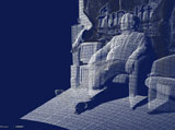
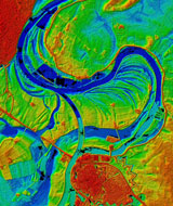
The first contribution is by Jantien Stoter (TU Delft), who discusses the feasibility of a multi-scale information model and one key register 'Topography' instead of the current practice with separate information models for every scale. The growing importance of the third dimension is addressed by Stefan Flos (SJF Projects & Support) exploring the (im)possibilities to treat the more raw height data, as currently collected in the context of Actueel Hoogtebestand Nederland-2 (AHN-2, Actual Height model of the Netherlands) as core spatial data. Airborne laser scanning is a technique applied to collect these data. However, terrestrial laser scanning also has many interesting applications; see Figure 2. In the third contribution of this publication, the members of the NCG Subcommission Core Spatial Data (Vosselman, Schröder, Van Essen, Heres, Klijnjan, Kroon, Van Oosterom, and Van Rossem) present their first research agenda consisting of 10 different themes. Next Frank van den Heuvel (CycloMedia) will address an another important type of core spatial data: aerial and ground-based imagery. The special role of Cadastral information among core spatial data is discussed by Jaap Zevenbergen (TU Delft & ITC), Harry Uitermark and Chrit Lemmen (Kadaster & ITC). Finally, Robert Kroon (Geodelta) will make clear that all these data do not come for free and without pain in the last contribution "Laissez-faire in the air, a real nightmare".
Contents
Introduction Core Spatial Data vii
Prof.dr.Ir. P.J.M. van Oosterom
Towards one domain model and one key register topography 1
Dr. J.E. Stoter
AHN in perspective: Dutch Digital Elevation Data (AHN) Core Spatial Data? 23
Ing. S.J. Flos MSc MMI
The research plan of the NCG Subcommission Spatial Core Data 33
Prof.Dr.ir. M.G. Vosselman, F.H. Schröder, Drs. R. van Essen, Ir. L. Heres, Ir.Drs. A.J. Klijnjan, Ir. R.J.G.A. Kroon, Dr. J.E. Stoter, Prof.Dr.Ir. P.J.M. van Oosterom, Ir. R.P.E. van Rossem
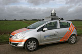
CycloMedia's aerial and ground based image databases 53
Dr.ir. F.A. van den Heuvel
Cadastral information: more than base data 63
Prof.dr. J.A. Zevenbergen, Dr.ir. H.T. Uitermark, Ir. C.H.J. Lemmen
Aspects concerning the use of spatial core data 81
Ir. R.J.G.A. Kroon
