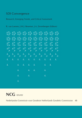
B. van Loenen, J.W.J. Besemer, J.A. Zevenbergen (Editors)
Nederlandse Commissie voor Geodesie 48, Delft, 2009. 288 pagina's.
ISBN: 978 90 6132 310 5.
From the Foreword
This book is the result of a collaborative initiative of the Global Spatial Data Infrastructure Association (GSDI), the European Commission's Joint Research Centre, the European umbrella organisation for geographic information (EUROGI), the Dutch innovation program Space for Geo-Information (RGI) and Geonovum, the Netherlands SDI executive committee. In addition to the traditional call for papers for the joint GSDI-11/ INSPIRE/ Geonovum RGI conference 'Spatial Data Infrastructure Convergence: Building SDI Bridges to Address Global Challenges' contributions of full articles were solicited for publication in this peer reviewed volume.
In several instances, the articles submitted addressed the theme of the conference. In others they stuck to the more traditional fields of SDI. The reviewing process resulted in twenty articles that together can be summarised as Spatial Data Infrastructure Convergence: Research, Emerging Trends, and Critical Assessment. These topics are represented well in this volume.
Contents
Foreword vii
Peer Review Board for SDI Convergence: Research, Emerging Trends, and Critical Assessment viii
Spatial Data Infrastructure Convergence 1
B. van Loenen, J. Besemer and J. Zevenbergen
The Potential of a National Atlas as Integral Part of the Spatial Data Infrastructure Exemplified by the New Dutch National Atlas 9
M-J. Kraak, F. Ormeling, B. Köbben and T. Aditya
Development and Deployment of a Services Catalog in Compliance with the INSPIRE Metadata Implementing Rules 21
J. Nogueras-Iso, J. Barrera, A.F. Rodr uez, R. Recio, C. Laborda and F.J. Zarazaga-Soria
Public Sector Geo Web Services: Which Business Model Will Pay for a Free Lunch? 35
F. Welle Donker
Standard Licences for Geographic Information: the Development and Implementation in Local Government in Italy 53
L. Garretti, S. Griffa, R. Lucà and M.T. Lopreiato
Legal Simcity; Legislative Maps and Semantic Web Supporting Conflict Resolution 63
R. Peters, R. Hoekstra, T. van Engers and E. Hupkes
Power and Privacy: the Use of LBS in Dutch Public Administration 75
C. van Ooijen and S. Nouwt
Harmonising and Integrating Two Domain Models Topography 89
J. Stoter, W. Quak and A. Hofman
An Analysis of Technology Choices for Data Grids in a Spatial Data Infrastructure 107
S. Coetzee and J. Bishop
SDI and Metadata Entry and Updating Tools 121
A. Rajabifard, M. Kalantari and A. Binns
A Prototype Metadata Tool for Land Use Change and Impact Models - a Case Study in Regional Victoria, Australia 137
S. Williams, C. Pettit, D. Hunter and D. Cherry
Implementation of Recent Metadata Directives and Guidelines in Public Administration: the Experience of Sardinia Region 151
L. Manigas, M. Beneventi, L. Corvetto, R. Vinelli and M. Melis
An Integrated Framework for the Implementation and Continuous Improvement of Spatial Data Infrastructures 161
A. Toomanian and A. Mansourian
The Value Chain Approach to Evaluate the Economic Impact of Geographic Information: Towards a New Visual Tool 175
E. Genovese, S. Roche and C. Caron
Evaluation of Spatial Information Technology Applications for Mega City Management 189
S. Boos and H. Mueller
Local Government and SDI - Understanding their Capacity to Share Data 205
K. McDougall, A. Rajabifard and I. Williamson
Changing Notions of a Spatial Data Infrastructure 219
I. Masser
Cooperation - a Key Factor for Sustainable Spatial Data Infrastructure 229
O. Olsson
Seamless SDI Model - Bridging the Gap between Land and Marine Environments 239
S. Vaez, A. Rajabifard and I. Williamson
The RRR Toolbox: a Conceptual Model for Improving Spatial Data Management in SDIs 253
R. Bennett and A. Rajabifard
Building SDI Bridges for Catchment Management 265
D. Raj Paudyal, K. McDougall and A. Apan
