

")
")


L. Heres
Publications on Geodesy 47, Delft, 2000. 70 pagina's.
ISBN-13: 978 90 6132 269 6. ISBN-10: 90 6123 269 3.
Summary
Most Geographic Information Systems started as a substitute for loose paper maps. These paper maps did not have a built-in time dimension and could only represent history indirectly as a sequence of physically separate images. This was in fact imitated by these first generation systems. The time dimension could only be represented by means of separate files.
A minority of Geographic Information Systems however, started their life as a substitute for ordered lists and tables with a link to paper maps. In these lists, the inclusion of a time com-ponent in the form of a data field was quite usual. This method too was copied by the systems that replaced these paper tables.
The current trend in the development of Geographic Information Systems is towards the inte-gration of the classical map-oriented concepts with the table-oriented concepts. This often leads to the explicit embedding of the time component in the GIS environment.
The Subcommission Geo-Information Models of the Netherlands Geodetic Commission has organized a workshop to discuss the theory and practice of time and history in GIS on 18 May 2000. This publication contains 6 articles prepared for the workshop.
The first paper, written by Donna Peuquet, gives a bird’s-eye view of the current state of the art in spatio-temporal database technology and methodology. She is a well-known expert in the field of spatio-temporal information systems and the author of many articles in this field.
The second article is written by Monica Wachowicz. She describes what you can do with a GIS once it contains a historical dimension and how you can detect changes in geographic phenomena. Furthermore, her article suggests how geographic visualisation and knowledge discovery techniques can be integrated in a spatio-temporal database.
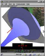
How to record the time dimension in a database is one thing, how to show this dimension to users is another one. In his contribution, Menno-Jan Kraak first tells about the techniques, which were used in the age of paper maps and the limitations these methods had. He goes on to explain what kind of cartographic techniques have been developed since the mass introduc-tion of the computer. Finally he describes the powerful animation methods which currently exist and can be used on CD-ROM and Internet applications.
Peter van Oosterom describes how the time dimension is represented in the information sys-tems of the Cadastre and how this is used to publish updates. The Cadastre has a very long tradition in incorporating the time component, which has always been an inherent component of the cadastral registration. In former times this was translated in very precise procedures about how to update the paper maps and registers. Today it is translated in spatio-temporal database design.
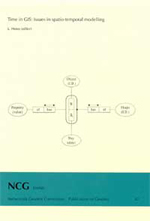
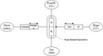
The article of Luc Heres tells about the time component in the National Road Database, origi-nally designed for traffic accident registration. This is one of the systems with ''table'' roots and with quite a long tradition in handling the time dimension. He elucidates first the core objects in the conceptual model and how time is added. Next, how this model is translated in a logical design and finally how this is technically implemented.
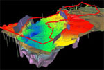
Geologists and geophysicians also have a respectable tradition in handling the time dimension in the data they collect. This is illustrated in the last paper, which is written by Ipo Ritsema. He outlines how time is handled in geological and geophysical databases maintained by TNO. By means of some practical cases he illustrates which problems can be encountered and how these can be solved.
Contents
- Luc Heres, Time in GIS: Issues in spatio-temporal modelling
- Donna J. Peuquet, Space-time representation: An overview
- Monica Wachowicz, The role of geographic visualisation and knowledge discovery in spatio-temporal data modelling
- Menno-Jan Kraak, Visualisation of the time dimension
- Peter van Oosterom, Time in cadastral maps
- Luc Heres, Hodochronologics: History and time in the National Road Database
- Ipo Ritsema, Time in relation to geoscientific data