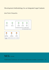
Deriving Portugal Country Model from the Land Administration Domain Model
João Paulo Hespanha
Publications on Geodesy 79
Delft, 2012. 363 pagina's. ISBN: 978 90 6132 337 2. Alleen verkrijgbaar als pdf.
Summary
This Thesis describes the research process followed in order to achieve a development methodology applicable to the reform of cadastral systems with a legal basis.
It was motivated by the author’s participation in one of the first surveying and mapping operations for a digital cadastre in Portugal, and the problems faced by the cadastre, and more generally, the Land Administration System in Portugal.
After approaching Delft University of Technology (more specifically OTB Research Institute) with a research proposal mainly applied and restricted to the Portuguese cadastral situation, it was suggested to propose a new Cadastral Data Model, to be derived from the (then called) Core Cadastral Domain Model. This last model has evolved into the current Final Draft International Standard ISO 19152 - Land Administration Domain Model (LADM).
The use of LADM as a fundamental contribution to the research, along with the participation in its development, allowed to expand from an applied and focused research context, to a more generic and widely applicable one. Although the main Case Study is still describing Land Administration in Portugal, the resulting development methodology equally benefited from the study of country models developed elsewhere in the World (Iceland, Queensland (Australia) and Canada (federal land)).
The generic and worldwide nature of the LADM allowed thus to formulate the main aim and research question of this Thesis:
How can a system development methodology support in a efficient and flexible manner the creation of an integrated legal Cadastre, while addressing the interrelations between the technical, legal and organisational aspects?
The remaining paragraphs of the summary will report on how the resultant development methodology was obtained, as well as the actual products from the implementation test on the existent Portuguese Cadastral Model (hereafter referred as PT CDM) leading to the single, most important outcome; the Portuguese country model, LADM PT.
Starting from the more generic concepts applied to the development methodology, the systems approach as applied to Land Registries, which recognizes different aspects under which the system can be examined and described (technical, legal, administrative and institutional), was the underlying concept for this Thesis, resulting from the contribution from (Zevenbergen, 2002).
The technical aspects of an integrated legal cadastre, or more generically, a Land Administration System, were the ones that received greater attention. The software development life cycle methodology called Unified Process (UP) and the Model Driven Architecture (MDA) supplied the more important concepts and procedures to derive a specific country model from the domain model.
Both sets of concepts (UP and MDA) were adapted and merged into the development methodology, taking into consideration the specifics of the different aspects of an integrated legal cadastre.
The design of the different components (translated to UML packages in the country model) has used a number of existing standards and specifications from international organizations as ISO, the Open GIS Consortium (OGC), the World Wide Web Consortium (W3C) and the Object Management Group (OMG). This way, it is heavily standards based.
On the legal aspects, the most important input to the research was the Legal Model as developed by (Paasch, 2005). This provided an object-oriented view reflecting generic legal concepts, as abstracted from a number of Western Europe legal frameworks, and which can be applied (at least) to both countries with Civil Code and with Common Law based legislations.
The administrative aspects were equally considered, namely by the integration of elements belonging to that component in LADM, with specific classes present in the Portuguese Cadastral Model. Additional UP products, which included UML defined elements such as the Use Case Model and related Activity Diagrams reflecting cadastral update procedures, were developed in complement to the country model.
The main institutions related to a legal based cadastre, namely those related with the fundamental institution of Property and the related Real Rights, and those related to the cadastral surveying and mapping component, were studied and reported for the Case Study. Contribution from Social Sciences in the fields of institutional theory were considered, concerning the institution of Property. In particular, the ontology description of Property is compared to the Domain Model description, identifying its similarities and differences.
The following list of items reports on the products developed by the application of the development methodology. It follows the steps to get from the non-compliant, existing Portuguese Cadastral Data Model (PT CDM) to the LADM based country profile LADM PT.
- Use Case Model, comprising a context and more aspect oriented Use Case Diagrams and the respective text templates. This is used to capture critical functional requirements, and constitutes a single inception iteration (according to UP).
- Vision document, identifying which problems the system will solve; who are the target users; what the system will offer in terms of features, and a listing of non-functional requirements. This is a result of the inception phase. The scope of the vision document is centred on two core capabilities, described next.
- Core Capability #1: Legal and Administrative component, covering the relation of Rights, Restrictions and Responsibilities (RRR) to the Spatial Units, through the Basic Administrative Unit. The terms name core classes belonging to the Domain Model.
- Core Capability #2: Geometric component, describing the organization of Spatial Units into different levels and considering geometry and topology constraints. This component specifies also cadastral surveying classes.
- Iteration plan for the UP Elaboration phase, which considered separate iterations for the core capabilities, followed by an integration iteration. Each iteration comprises: A detailed Use Case; a Design Model; use of one or more LADM profiles (UML patterns); a complete design model; MDA transformations and ORM Mappings enabling the implementation into a spatial data base.
- Transformation chain (MDA) for the integrated model, merging LADM with the legacy model and considering the LADM profiles.
- Instance Level Diagrams, which document the application of the integrated model for a number of real life, concrete cases.
- Model constraints collected into an OCL file (a formal constraint language), tested for syntax, and from which additional code can be derived.
The fundamental contribution and answer to the main research question is thus the development methodology itself, whose products are referred above for the LADM PT country model. But the research path followed to obtain this methodology provided other contributions, which are summarized in the following list.
- Standards based modelling and development, namely considering geographic information (ISO 19000) series of international standards, OMG modelling standards for UML and OCL, or OGC standards in the spatial feature types.
- Development and later inclusion in LADM of spatial unit and legal profiles, specified as UML patterns which can be used in order to derive other country models besides LADM PT.
- Documentation of a series of specific Land Administration cases through the production of Instance Level Diagrams, which are annexed to the (ISO/TC211 Geographic Information / Geomatics, 2011).
Finally, the results obtained so far, namely considering the data in the implementation test (a subset of model elements belonging to the derivation of LADM PT from LADM), identified a number of paths open to future research.
The most relevant would be the specification of the dynamics of RRR’s through time in a way that future results are integrated into the methodology. The legal model of other forms of property (legal regimes) besides those already considered for the realm of private property will also benefit a Land Administration System, extending its role from the traditional Land Registry and Cadastre.
In the Information Technology field, the research and development of an enhanced set of open source CASE tools assisting the derivation process, following MDA principles, is highly desirable. In particular, the support for the specification of OCL constraints in all phases of the derivation process should be further improved.
At last, and considering the expected approval of LADM as ISO 19152 in the short term, a documented procedure should be agreed by future contributors to the Domain Model itself, and mainly to the reporting of new country models, for which this Thesis can provide a first input.
Table of contents
1. Introduction ... 1
2. Land Administration Development Methodologies ... 25
3. Land Administration in Portugal ... 79
4. A methodology for Land Administration system development ... 115
5. Implementation Test ... 191
6. Conclusions and Recommendations ... 223
A. LADM PT Model Diagrams ... 235
B. SFS Profile ... 253
C. CASE Tools Documentation ... 257
D. Implementation Test Results ... 273
E. UP Inception Documents ... 277
F. Other Country Models ... 299
Bibliography ... 313
Summary ... 331
Samenvatting ... 335
Sumario em Portugues ... 339
Curriculum Vitae ... 343
Samenvatting
Dit proefschrift beschrijft het onderzoeksproces dat heeft geleid tot een systeemontwikkelmethodiek
voor de hervorming van juridisch kadastrale systemen.
De motivatie komt voort uit deelname van de auteur aan een van de eerste meet- en karteringsoperaties voor een digitaal kadaster in Portugal, en de problemen waarmee het kadaster, en meer in het algemeen het land administratiesysteem, in Portugal worstelt.
Na het benaderen van de Technische Universiteit Delft (meer specifiek het Onderzoeksinstituut OTB) met een toepassingsgericht onderzoeksvoorstel gericht op de Portugese kadastrale situatie, werd voorgesteld om een nieuw kadastraal gegevensmodel te ontwikkelen, gebaseerd op het toenmalige CCDM ('Core Cadastral Domain Model'; kadastraal kern domein model). Dit laatste heeft zich inmiddels ontwikkeld
tot het huidige FDIS ('Final Draft International Standard', definitieve concept internationale standaard) ISO 19152 - Land Administration Domain Model (LADM; land administratie domein model).
Het gedocumenteerde gebruik van LADM (een aanzienlijke onderzoeksbijdrage op zich), ging gepaard met deelname aan de LADM ontwikkeling. Dit maakte de uitbreiding mogelijk van een toegepast en Portugees gericht onderzoek naar een meer generiek en breed toepasbaar onderzoek. Hoewel de belangrijkste casestudie nog steeds de beschrijving van de land administratie in Portugal is, heeft de beschreven systeemontwikkelmethodiek even zozeer geprofiteerd van de bestudering van elders in
de wereld ontwikkelde modellen (IJsland, Queensland (Australi) en Canada (federaal land)). Het generieke en wereldwijde karakter van de LADM maakte het mogelijk om de centrale onderzoeksvraag als volgt te formuleren:
Hoe kan een systeemontwikkelmethodiek ondersteuning bieden aan het efficiënt en flexibel realiseren van een geïntegreerd juridisch kadaster, met aandacht voor de onderlinge relaties tussen de technische, juridische en organisatorische aspecten?
De rest van deze samenvatting beschrijft de wijze waarop tot de resulterende systeemontwikkelmethodiek is gekomen, evenals de gerealiseerde producten van de implementatie test op het bestaande Portugese kadastrale model (hierna PT CDM), dat geleid heeft tot het belangrijkste resultaat: het Portugese land-specifieke model, LADM PT.
Uitgaande van een generieke ontwikkelmethodiek, is de systeembenadering toegepast op kadasters, waarmee verschillende aspecten worden onderzocht en beschreven (technische, juridische, administratieve en institutionele), zijnde het onderliggende concept van dit proefschrift; conform (Zevenbergen, 2002).
De technische aspecten van een geïntegreerd juridisch kadaster, of meer algemeen, een land administratiesysteem, hebben de meeste aandacht gekregen. De software ontwikkelmethodiek genaamd 'Unified Process' (UP) en de 'Model Driven Architecture' (MDA; model gedreven architectuur) aanpak zorgen voor de belangrijkste concepten en procedures voor het uit de domein standaard afleiden van een landspecifiek model.
Beide verzamelingen concepten (UP en MDA) werden aangepast en samengevoegd tot de ontwikkelmethodiek, met inachtneming van de specifieke kenmerken van de verschillende aspecten van een geïntegreerd juridisch kadaster.
Het ontwerp van de verschillende model componenten (vertaald naar 'UMLpackages' in het land-specifieke model) heeft gebruik gemaakt van een aantal bestaande standaarden van internationale organisaties, waaronder de International Organization for Standardization (ISO), het Open Geospatial Consortium (OGC), het World Wide Web Consortium (W3C) en de Object Management Group (OMG). Op deze manier is het ontwerp sterk op standaarden gebaseerd.
Voor het juridische deel was de belangrijkste input voor het onderzoek het juridische model zoals ontwikkeld door (Paasch, 2005). Dit leverde een objectgeoriënteerd model op met generieke juridische begrippen, geabstraheerd vanuit een aantal West-Europese juridische stelsels, welke zowel in continentaal Europa (met op een burgerlijk wetboek gebaseerde wetgeving), als op de Britse eilanden (met op jurisprudentie gebaseerde wetgeving) kan worden toegepast.
De administratieve aspecten werden eveneens onderzocht, namelijk door de integratie van elementen van deze component in LADM met specifieke klassen aanwezig in het Portugese kadastrale model. Extra UP producten in de vorm van UML 'Use Case Diagram' (gebruikssituaties) en UML 'Activity Diagram' (activiteiten) voor kadastrale update procedures, werden ontwikkeld in aanvulling op het land-specifieke
model (UML 'Class Diagram' (klassen)).
De belangrijkste instanties met betrekking tot een juridisch kadaster, gerelateerd aan zowel eigendom en beperkt zakelijke rechten), als aan kadastrale meting en kartering, werden bestudeerd en beschreven voor de Portugese casestudie. Bijdragen van de Sociale Wetenschappen op het gebied van institutionele theorie werden beschouwd, met betrekking tot het begrip eigendom. In het bijzonder een ontologie gebaseerde beschrijving van het begrip eigendom is vergeleken met een domein modelgebaseerde
beschrijving, waarbij verschillen en overeenkomsten zijn geïdentificeerd.
De volgende lijst geeft de tussenproducten van het toepassen van de voorgestelde systeemontwikkelmethodiek aan. Het volgt de stappen om van het niet-conforme Portugese kadastrale model (PT CDM) tot het op LADM gebaseerde land-specifieke model LADM PT te komen.
- Use Case Diagram, bestaande uit een algemene context en meerdere aspect gerichte gedetailleerde Use Case diagrammen met bijbehorende tekstsjablonen. Dit wordt gebruikt om essentiële functionaliteit vast te leggen, en vormt de beginfase ('inception iteration' (start iteratie) volgens UP).
- Visiedocument met identificatie van de problemen die het systeem gaat oplossen, wie de beoogde gebruikers zijn, wat het systeem zal bieden in termen van functionele aspecten en niet-functionele aspecten. Dit is een resultaat uit de beginfase. Het visiedocument is gericht op twee belangrijke onderdelen, hieronder beschreven.
- Kernonderdeel #1: de juridische en administratieve component, waarbij de relatie van rechten, beperkingen en verantwoordelijkheden (LA RRR) naar de ruimtelijke eenheden (LA SpatialUnit, d.w.z. percelen) wordt gelegd via de basis administratieve eenheden ('LA BAUnit'). De namen voor deze kernklassen komen uit het LADM.
- Kernonderdeel #2: de geometrische component voor het beschrijven van de ruimtelijke eenheden (LA SpatialUnit) in verschillende lagen en rekening houdend met de mogelijke geometrische en topologische constructies. Dit onderdeel omvat ook de klassen voor de kadastrale metingen (LA SpatialSource).
- Iteratieslag voor de UP Uitwerkingsfase, die aparte iteraties onderscheidt voor de kernonderdelen, gevolgd door een integratie iteratie. Elke iteratie bestaat uit: een gedetailleerde use case beschrijving, een globaal ontwerp model, het gebruik van één of meer LADM profielen (UML patronen), een gedetailleerd ontwerp model, MDA transformaties en ORM (object relationele model) transformaties nodig voor de implementatie in een ruimtelijke database.
- Transformatie keten (MDA) voor het geïntegreerde model (met zowel de juridische en administratieve component als de geometrische component), waarin het LADM model is gecombineerd met het bestaande model met verdere toepassing van de LADM profielen.
- Objectinstantie diagrammen (UML 'instance level diagrammen') welke het gebruik van het geïntegreerde model illustreren voor een aantal realistische concrete situaties.
- Model geldigheidscondities ('constraints') welke zijn vastgelegd in OCL (een formele taal voor geldigheidscondities) en gecheckt voor wat betreft de syntax en waaruit extra code gegeneerd kan worden voor het afdwingen van geldige data bij opslag.
De fundamentele bijdrage en het antwoord op de centrale onderzoeksvraag is de systeemontwikkelingmethodiek zelf, waarvan de producten hierboven zijn genoemd voor het LADM PT land-specifieke model. Maar het onderzoek om tot deze methodiek te komen heeft ook nog andere resultaten opgeleverd, welke als volgt kunnen worden samengevat:
- Standaardengebaseerde modellering en ontwikkeling, met name op basis van de geografische informatie (ISO 19000) serie van internationale standaarden, OMG modelleringsstandaarden voor UML en OCL, en OGC standaarden voor ruimtelijke objecttypen.
- Ontwikkeling (en latere opneming in LADM) van model profielen voor de ruimtelijke eenheden en de juridische component, gespecificeerd als UML patronen die kunnen worden gebruikt om hieruit ook andere land-specifieke modellen dan LADM PT te ontwikkelen.
- Documentatie van een reeks realistische concrete land administratie situaties door de het maken van aantal UML objectinstantie diagrammen, welke als bijlage aan de FDIS LADM zijn toegevoegd (ISO/TC211 Geographic Information / Geomatics, 2011).
De ervaringen en resultaten tot dusver verkregen bij de uitvoering van de testen (met gegevens binnen een subset van het LADM PT model) geven aanleiding voor een aantal toekomstige onderzoeksvraagstukken.
Belangrijk toekomstig onderzoek dient zich te richten op hoe met de dynamiek van RRRs in de tijd moet worden omgegaan, zodanig dat toekomstige resultaten in de methodologie ge¨ıntegreerd zullen zijn. Daarnaast zou het juridische model verder moeten worden uitgebreid met andere vormen van RRRs (gebaseerd op wettelijke regelingen) naast de gemodelleerde vormen van privaatrechtelijke eigendom. Dit komt ook ten goede aan een uitbreiding van rol van een kadaster systeem richting een land
administratiesysteem.
Op het gebied van de informatietechnologie, is meer onderzoek naar en de ontwikkeling van verbeterde open source CASE-tools voor het beter ondersteunen van het ontwikkelproces volgensMDA principes zeer gewenst. Met name de ondersteuning van geldigheidscondities (constraints) in alle fasen van de ontwikkelproces moet verder worden verbeterd.
Tenslotte, en rekening houdend met de verwachte goedkeuring van LADM als ISO 19152 standaard op de op korte termijn, is het van belang dat er een gedocumenteerde procedure voor het continue beheer van het LADM wordt overeengekomen. Daarnaast moeten er ook afspraken worden gemaakt voor de rapportage van nieuwe op LADM gebaseerde land-specifieke modellen, waarvoor dit proefschrift een eerste aanzet geeft.
