

")
")


Prof.Dr.Ir. M.G. Vosselman, F.H. Schröder, Drs. R. van Essen, Ir. L. Heres, Ir.Drs. A.J. Klijnjan, Ir. R.J.G.A. Kroon, Dr. J.E. Stoter, Prof.Dr.Ir. P.J.M. van Oosterom, Ir. R.P.E. van Rossem
NGC commission Spatial Core Data, the Netherlands
Abstract
In 2007 the Netherlands Geodetic Commission (NCG) installed the commission Spatial Core Data to discuss, co-ordinate and initiate research in the field of acquisition, representation and usage of the spatial core data. This document describes the areas in which the commission wants to be active and identifies the open research questions.
Introduction
The commission Spatial Core Data of the Netherlands Geodetic Commission was installed in 2007 to discuss, co-ordinate and initiate research in the field of acquisition, representation and usage of the spatial core data.
Currently, eight scientists and experts from universities, government agencies and companies cooperate in this commission. The members are: Drs. R. van Essen (Tele Atlas), Ir. L. Heres (RWS-DID), Drs.Ir. A.J. Klijnjan (Dutch Land Registry Office (Kadaster)), Ir. R.G.A. Kroon (Ingenieursbureau Geodelta B.V.), Prof.Dr.Ir. P.J.M. van Oosterom (TU Delft), Ir. R.P.E. van Rossem (Ministry of Housing, Spatial Planning and the Environment), Dr. J.E. Stoter (TU Delft), and Prof.Dr.Ir. M.G. Vosselman (chairman, ITC).
The field of research of the commission is sketched in this document and elaborated in ten themes. The themes can roughly be divided into two categories: research on interpreted core data (most often vector data) and research on raw or uninterpreted data as acquired by various kinds of sensors.
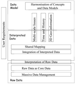
Theme 1. User Requirements
Research on raw core data
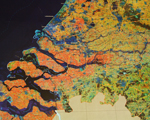
Theme 2. Raw Data as Core Data
Theme 3. Massive Data Management
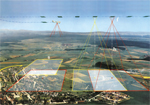
Theme 4. Interpretation of Raw Data
Research on interpreted core data
Theme 5. Harmonisation of Concepts and Data Models
Theme 6. Integration of Interpreted Data
Theme 7. Multi-scale Issues
Theme 8. Time and History
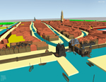
Theme 9. 3D Geo-information
Theme 10. Shared Mapping
These themes are mutually related. Their relationships are illustrated in the diagram below, around the notions of Data Model, Interpreted Data and Raw Data.
The themes are described in the pdf: >> The research plan of the NCG commission Spatial Core Data